In 1513, Ottoman Admiral Piri Reis made a map that amazed historians for centuries. The Piri Reis Map shows parts of the Americas and possibly Antarctica. These areas were unknown to Europeans back then. This map questions our understanding of exploration and cartography, sparking debates about ancient knowledge and its surprising accuracy.
The Piri Reis Map’s coastlines and mysterious notes still intrigue researchers. It was found in 1929 in the Topkapi Palace. Scientists are still studying it, trying to uncover secrets of early exploration and navigation.
Discovery and Historical Context of the Ottoman Map
The Piri Reis map was found in 1929 at the Topkapi Palace in Istanbul. It was a 16th-century cartographic wonder. Its discovery sparked interest because it showed lands unknown to Europeans, like parts of the Pre-Modern Navigation and Exploration History. The map was made during the Ottoman Empire’s golden age of sea travel, showing their advanced Pre-Modern Navigation and map-making skills.
The 1929 Topkapi Palace Discovery
Theologian Gustav Adolph Desman found the Piri Reis map. He saw its importance and the questions it raised about early Exploration History. The map’s detailed views of the Americas and possibly Antarctica amazed scholars and the public, starting a big discussion.
The Ottoman Empire’s Maritime Golden Age
In the 16th century, the Ottoman Empire grew a lot through sea travel and exploration. Piri Reis, a famous admiral and cartographer, used the empire’s knowledge and resources to make his world map. This map showed the Ottomans’ skill in Pre-Modern Navigation and map-making, challenging European views on exploration and geography.
Initial Reception and Historical Impact
The discovery of the Piri Reis map in 1929 changed how we see early Exploration History. Its detailed views of new lands, like parts of the Americas and possibly Antarctica, questioned old stories and started many debates. The map’s first reaction showed its big role in changing our view of global exploration and map-making.

The Life and Legacy of Admiral Piri Reis
Piri Reis was born in 1465 and lived until 1553. He was an Ottoman admiral, cartographer, and author. He played a big role in the Golden Age of Ottoman maritime exploration.
He learned how to navigate from his uncle, Kemal Reis. Then, he sailed the Mediterranean. He gathered a lot of geographical knowledge.
In 1513, Piri Reis made a famous world map. It combined maps from Ptolemy, Portugal, and Arabs. This map is known for its accurate placement of continents, especially Africa and South America.
Piri Reis wrote the Kitab-ı Bahriye (The Book of Navigation) in 1521 and updated it in 1525. It’s a detailed guide on navigation, covering many areas. Over 40 copies of this book still exist today.
Despite his achievements, Piri Reis met a sad end. He was executed in Egypt in 1553 after losing a battle against the Portuguese in Basra. His tragic death has made his legacy even more memorable.

Ancient Sources and Mysterious Origins
The Piri Reis map, made in 1513, is full of mystery. It was created by Piri Reis, a famous Ottoman cartographer. He used about 20 ancient maps and charts to make his world map.
These sources went back to Alexander the Great’s time. They might even have come from ancient China. This makes the map even more mysterious and full of geographic knowledge.
The Twenty Lost Maps Theory
The Piri Reis map is also known for the “Twenty Lost Maps Theory.” Piri Reis said he had access to many ancient maps, some lost forever. The old and varied sources have sparked debates about ancient geography and lost civilizations.
Columbus Connection and Portuguese Charts
The map is also linked to Christopher Columbus. Piri Reis used info from a Castilian prisoner who sailed with Columbus. This adds to the map’s rich and mysterious past.
The map also shows Portuguese chart influences. This shows how early European explorers shaped the region’s maps.
Alexandria Library References
References to the Library of Alexandria add to the map’s mystique. The Library of Alexandria was a famous learning center in the ancient world. Its vast collections of scrolls and maps have sparked endless curiosity.
The possible use of materials from this legendary library makes the Piri Reis map even more fascinating. It’s a true treasure of Mystery Maps and Geographic Knowledge.
The Piri Reis Map Creation Process
The Antique Charts of the Ottoman Empire, like the famous Piri Reis Map, show off the advanced Pre-Modern Navigation of that time. Piri Reis, a skilled Ottoman admiral and cartographer, made his world map in 1513. He mixed ancient knowledge with new discoveries.
The Piri Reis Map was drawn on gazelle skin parchment. It shows the advanced cartography of the Ottomans. Piri Reis used information from sailors, explorers, and over 20 maps from different places, like Greece, Portugal, and Arabia.
Piri Reis’s years at sea and his knowledge as an Ottoman naval officer made his map detailed and accurate. He combined old wisdom with new discoveries. This made his map a fascinating and groundbreaking work that still interests many today.

“The Piri Reis Map stands as a testament to the Ottoman Empire’s mastery of Pre-Modern Navigation and cartography, blending timeless wisdom with the spirit of discovery that defined the age.”
Geographical Features and Coastline Accuracy
The Piri Reis map, made in 1513 AD, is known for its accurate coastlines. It shows the eastern coast of South America and parts of Africa with great detail. The Brazilian coast is especially precise, surprising today’s cartographers.
This level of detail in the 16th century is amazing. It was done with limited geographic knowledge and tools.
South American Coastline Analysis
The Piri Reis map accurately draws the South American coastline. It was made over two centuries before the first accurate surveys. This shows Piri Reis’s skill in ancient cartography.
The map’s detail on the Brazilian coast has sparked a lot of study. People wonder how Piri Reis got such precise information.
African Shore Representations
The map also shows the African shore with great detail. The western African coast is especially accurate, given the time. This shows Piri Reis had a lot of information to work with.
Caribbean Islands Depiction
The Piri Reis map also accurately shows the Caribbean islands. The map’s detail on these islands shows Piri Reis’s knowledge of ancient cartography.

The Piri Reis map’s accuracy has led to a lot of study. People are trying to figure out how Piri Reis did it. This map is a window into the past, showing how geographic knowledge has evolved.
The Antarctic Enigma
The Piri Reis Map, from the 16th century, has always been a mystery. It shows a landmass in the south that some think is Antarctica. This has caused a lot of debate and guessing.
Scientists say Antarctica has been icy for 14 million years. This makes it hard to believe the map shows Antarctica without ice. Many theories have come up, like ancient knowledge or even aliens.
Piri Reis said he made the map from twenty older maps, even from Alexander the Great’s time. This means the map might have used knowledge from ancient Greeks. They knew the Earth was round and helped map it.
| Key Facts about the Piri Reis Map and Antarctica | Value |
|---|---|
| Year the Piri Reis Map was drawn | 1513 |
| Continent depicted on the map that was not officially discovered until 1820 | Antarctica |
| Years Antarctica has been covered in ice, according to scientific research | 14 million |
| Number of older maps Piri Reis claimed to have used to create his map | 20 |
The Mystery Maps and Controversial Artifacts around the Piri Reis Map’s Antarctica are still a big deal. Even though science questions the map’s accuracy, it keeps us curious about our past.
Cartographic Techniques and Materials
The Piri Reis Map is a marvel of ancient cartography from the 16th century. Piri Reis, an Ottoman admiral and cartographer, made it between 1513 and 1517. He used many sources to create a map that was very accurate for its time.
Gazelle Skin Parchment Usage
The Piri Reis Map was made on gazelle skin parchment. This shows the Ottomans’ focus on making maps last. They used high-quality materials, showing their dedication to world map origins and exploration.
Ottoman Mapping Methods
The map uses portolan charts and different projections. This mix made the map both beautiful and accurate. Piri Reis drew from many sources, including Christopher Columbus. The map’s detail and accuracy highlight Ottoman ancient cartography at its peak.
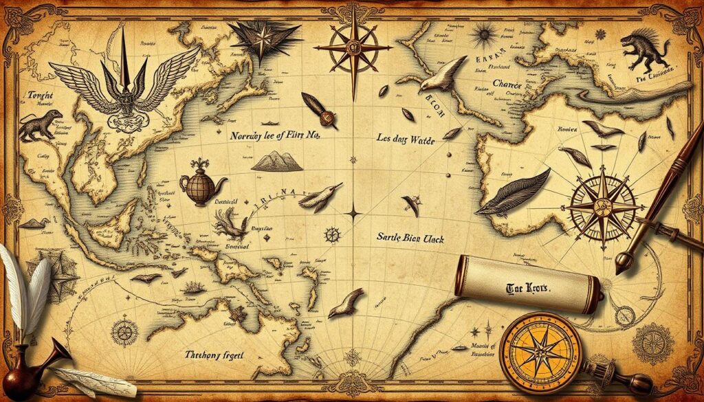

“Piri Reis produced the First World Map in 1513 depicting parts of West Africa and Central and Eastern America, as well as the Second World Map in 1528 representing the eastern coasts of North America, both considered the most accurate maps of his time.”
Mysterious Annotations and Symbols
The 16th-century Piri Reis Map is famous for its accurate geography and mysterious notes. These notes are in Ottoman Turkish and offer clues about the map’s origins and what it shows.
Many of the notes talk about mythical creatures and unknown lands. The map also has symbols of exotic animals and ships. These add to the mystery of this Controversial Artifact in Ancient Cartography.
Experts and researchers are fascinated by these symbols and notes. They think these might reveal secrets about the map’s creation or even hidden lands and cultures.
The study of the Piri Reis Map keeps bringing attention to these enigmatic symbols. They continue to spark debate, encouraging more research into this remarkable Controversial Artifact of Ancient Cartography.
Scientific Analysis and Modern Perspectives
The Piri Reis Map has fascinated scholars for centuries. Modern science has given us new insights into its creation and accuracy. By comparing the map with satellite images, researchers have confirmed its detailed depiction of many places.
This includes the coastlines of South America, Africa, and the Caribbean islands.
Contemporary Research Findings
Some claims about the map’s accuracy have been proven wrong. Yet, it’s still a key historical document. It offers valuable insights into 16th-century Geographic Knowledge and cartography.
Piri Reis, the Ottoman admiral who made the map, was a master of nautical science. His work shows the advanced Exploration History of the Ottoman Empire during its peak.
Geological Evidence
Geologists have looked into the map’s Antarctic coastline. It shows an ice-free area that matches the geological record. This has sparked debates about the map’s origins.
Some think it might have come from even older, advanced civilizations. The Piri Reis Map still fascinates and challenges our views on early cartography and exploration.
“The Piri Reis Map remains a tantalizing enigma, offering glimpses into the past that continue to inspire wonder and scholarly inquiry.”
Cultural and Historical Significance
The Piri Reis Map is a key piece of Ottoman cartography, showing the empire’s deep knowledge of the seas. It’s a symbol of the exchange of ideas between cultures during the Age of Exploration. Reis used maps from Ptolemy, an Arabic map of India, and Portuguese charts to create it.
In 1929, the map was found at the Topkapi Palace in Istanbul. This discovery sparked many theories about its origins, from ancient sea kings to aliens. The ongoing study of the map shows our fascination with history and how our understanding of the world has changed.
The Piri Reis Map is more than just a map. It shows the cultural and intellectual exchange of the Ottoman Empire’s golden age. The map combines Islamic mapping traditions with symbolic codes and fictional elements. It continues to fascinate scholars and the public, linking the past to the present and highlighting the Ottoman Empire’s lasting impact on exploration and cartography.
Source Links
- https://www.factualamerica.com/the-unseen-realm/12-documentaries-on-the-mystery-of-the-piri-reis-map
- https://memorycherish.com/piri-reis-map/
- https://www.discoveryuk.com/mysteries/the-piri-reis-map-a-conundrum-of-ancient-cartography/
- https://nwcartographic.com/blogs/essays-articles/the-piri-reis-map?srsltid=AfmBOopnBRWP-wzJhrqh3sCBRQXas-X_LyigBZJQvUpmkdWstEaFfzMP
- https://www.trtworld.com/magazine/piri-reis-admiral-extraordinaire-the-champion-of-ottoman-cartography-42239
- https://en.wikipedia.org/wiki/Piri_Reis
- https://muslimheritage.com/piri-reis-16th-c-cartographer-navigator/
- https://www.kathryngauci.com/blog-33-23052016-piri-reis-ottoman-admiral-cartographer/
- https://en.wikipedia.org/wiki/Piri_Reis_map
- https://www.ancient-origins.net/antarctica-ancient-technology/piri-reis-map-evidence-ancient-technology-00276
- https://medium.com/@mtesting2383/pages-from-the-history-the-piri-reis-map-a-comprehensive-analysis-of-facts-theories-and-myths-3760e4256fe7
- https://www.maritimegoods.com/en/content-details/mystery-on-the-map-of-piri-reis.html?ContentID=249
- https://blog.geogarage.com/2022/12/did-piri-reis-map-show-antarctica.html
- http://www.ancient-wisdom.com/pirireismap.htm
- https://ahotcupofjoe.net/2017/02/piri-reis-map-claims-antarctica/
- https://www.mysailing.com.au/charting-the-heavens-and-earth/
- https://atlantipedia.ie/samples/tag/piri-reis-map/
- https://historychronicles.org/piri-reis-map-an-ageless-enigma/
- https://www.crystalinks.com/pirireis.html
- https://www.academia.edu/15279181/The_Piri_Reis_Map_of_1513_is_Important_Because_
- https://cartography-gis.com/docsbca/iccgis2016/ICCGIS2016-45.pdf
- https://blog.geogarage.com/2011/05/colombus-and-piri-reis-map-of-1513.html
- https://travelatelier.com/blog/piri-reis/
- https://www.ancient-origins.net/artifacts-other-artifacts/mysterious-map-emerges-dawn-egyptian-civilization-and-depicts-antarctica-021520
- https://muslimheritage.com/piri-reis-maps-america/
- https://nwcartographic.com/blogs/essays-articles/the-piri-reis-map?srsltid=AfmBOopPAflfUZTUKpkp75iYXtrBqjdRq7KiCJzM9SnhmzsJMdKo5_Iv
- https://cupola.gettysburg.edu/cgi/viewcontent.cgi?article=1010&context=histfac
